Economic Development Authority
Marshall County Economic Development Authority
Location
Marshall County provides access to both Highway 75 and I-35 Corridors. We are 120 miles from both Dallas and Oklahoma City. In addition, we are within close proximity to Ardmore, OK, Durant, OK, and Sherman/Denison, TX.
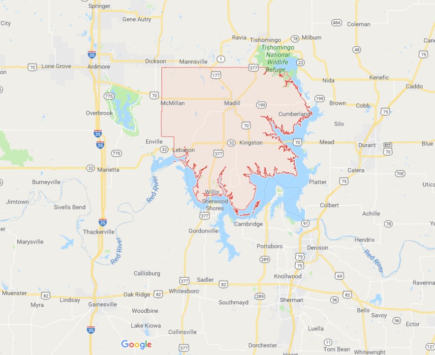
Marshall County has two airports, located near the towns of Madill and Kingston.
MADILL AIRPORT - 1F4
Madill, OK 73446
FAA Identifier: 1F4
Lat/Long: 34-08-25.4470N 096-48-43.3160W
34-08.424117N 096-48.721933W
34.1404019,-96.8120322 (estimated)
Elevation: 890 ft. / 271.3 m (surveyed)
Variation: 06E (1995)
From city: 3 miles NW of MADILL, OK
Time zone: UTC -5 (UTC -6 during Standard Time)
Zip code: 73446
NOTAMs facility: MLC (NOTAM-D service available)
Attendance: UNATNDD
Wind indicator: lighted
Segmented circle: yes
Lights: MIRL RY 18/36 PRESET MED INTENSITY DUSK-0000. AFTER 0000 ACTVT - CTAF.
Beacon: white-green (lighted land airport)
Operates sunset to sunrise.
Runway 18/36
Dimensions: 3005 x 60 ft. / 916 x 18 m
Surface: asphalt, in good condition
Weight bearing capacity:
Single wheel: 8.0
Runway edge lights: medium intensity
LAKE TEXOMA STATE PARK AIRPORT – F31
Kingston, OK 73439
FAA Identifier: F31
Lat/Long: 33-59-27.8000N 096-38-33.8000W
33-59.463333N 096-38.563333W
33.9910556,-96.6427222 (estimated)
Elevation: 693 ft. / 211 m (estimated)
Variation: 06E (1985)
From city: 4 miles E of KINGSTON, OK
Time zone: UTC -5 (UTC -6 during Standard Time)
Zip code: 73439
NOTAMs facility: MLC (NOTAM-D service available)
Attendance: UNATNDD
Wind indicator: lighted
Segmented circle: no
Lights: MIRL RY 18/36 PRESET LOW INTST; TO INCR INTST ACTVT - CTAF.
Beacon: white-green (lighted land airport)
ROTG BCN OTS INDEFLY. Operates sunset to sunrise.
Runway 18/36
Dimensions: 3000 x 50 ft. / 914 x 15 m
Surface: asphalt, in fair condition
Weight bearing capacity:
Single wheel: 4.0
Runway edge lights: medium intensity